Güralp Instruments implemented to monitor the seismicity of the Tuxtla volcanic field, Mexico.

Mexico is home to about a dozen active volcanoes, some of which remain unmonitored as they are considered “quiescent” (less active). Although volcanic activity is less frequent, these volcanoes can suddenly become very active and as a result they have the potential to impact the safety of thousands of people (Espindola and Zamora-Camacho, 2017). As an example, in 1982, the unmonitored volcano, El Chichón erupted and the lack of warning resulted in the death of 2000 people.

San Martin Tuxtla is one such volcano in the Tuxtla volcanic field (TVF), where the development of a seismic network has important implications for determining the seismicity of the region, and anticipating potentially devastating eruptions.
Studies in the TVF area have shown that there have been at least 9 eruptions in the last 9000 years, the most recent of which were in 1664 and 1793.  Accounts of the 1793 eruption describe a 3-event eruption that affected an area over 180,000 km2, in which heavy ash clouds spread and woods were set alight.
 
Commencing in 2007, the Universidad Nacional Autónoma de México (UNAM) set up a project in collaboration with Güralp Systems Ltd, to monitor the volcanic seismicity of the TVF area using a seismic network of Güralp 6TD broadband seismometers. 

Güralp Solution

Three Güralp 6TD broadband seismometers were installed in February 2007 around the San Martin Tuxtla volcano (Figure 2).  The sensors were integrated with CD24 digitisers, enabling ease of deployment and portability.
The Güralp 6TDs are broadband, force-feedback digital seismometers with three orthogonal components. The instruments are high sensitivity (2*1200 V/m/s) with a frequency response of 30s to 100Hz.  The on-board digitiser is 24-bit with configurable output and up to 32GB of Flash memory. 

Deployment

Wells were dug into the ground with bottomless plastic drums inserted to prevent collapse of the walls.  The instruments were placed inside the drums on concrete banks for good ground contact and set to record continuously at 100 samples per second, with data collected every month and analysed using Güralp Scream! Software. 

Outcome

During the deployment period of 2007-2010, 208 events were recorded in at least one of the three stations, and 51 events at two stations.  
The results of this analysis showed that the overall seismicity of the TVF is low, and the nature of the events suggested that they were due to tectonic or thermal stresses in the area and hydrologic conditions.  The results of the study will provide a baseline level of seismicity of the area with which to judge anomalous events that could indicate a risk of eruption.

Temporary monitoring of volcanic unrest

The Tongariro volcanic complex in New Zealand is a composite cone volcano formed over 275,000 years. Following increased volcanic activity at one of the cones - the upper Te Maari crater - in the summer of 2012, a temporary array of four Güralp sensors were installed to capture data on the ongoing unrest.

On August 6th 2012 the upper Te Maari vent erupted causing a debris flow to occur. This debris flow created a temporary dam in the Mangatetipua stream channel blocking all the outflowing water. The blockage of all the outflowing water created an ephemeral lake behind the debris flow dam.

Two months later on October 13th following heavy rainfall, the dam broke releasing ~50,000 m3 of water, which remobilized sediment including debris flow material. The sediment water mixture flowed down the channel creating a lahar.

With the temporary Guralp array in place both the August 6th and October 13th events were recorded seismically for further study.

Guralp 6T Array

In July 2012 four 3-component Guralp 6T broadband sensors were installed around the upper Te Maari vent in response to increased volcanic activity (Fig.2). These four sensors (TON1, TON2, TON3, TON4) were installed and maintained by GNS (Institute of Geological and Nuclear Science).

The August 6th debris flow destroyed TON2 and on August 22nd station TON7 was installed for the continuation of monitoring Te Maari. The Güralp 6T sensors were remotely operated and recorded with 24-bit digitisers at 100 Hz sampling rates and contained local GPS time stamps.

Successful recording of seismic data from volcanic debris flow

The five temporary Güralp 6T broadband sensors ensured that the dynamics and location of the August 6th debris flow and October 13th 2012 lahar could be estimated.

Both studies used a new method called the active seismic source method where the use of active sources (also recorded on the temporary Güralp sensors) were used to determine the properties of the mass flows by comparing the active source seismic data with that of the mass flow data.

The successful recording and analysis of seismic data at Te Maari was reliant on the ability to install temporary arrays on and around an active volcano. This technique to analyze volcanic mass flows can be easily adapted for volcanoes around the world and provides a foundation for new lahar monitoring techniques.

Monitoring Strike-slip faulting during Volcanic Activity, central Iceland

Iceland is a highly volcanic island lying upon the Mid-Atlantic ridge, the major boundary between the North American plate and the Eurasian plate. Iceland frequently experiences seismic activity and volcanic eruptions.

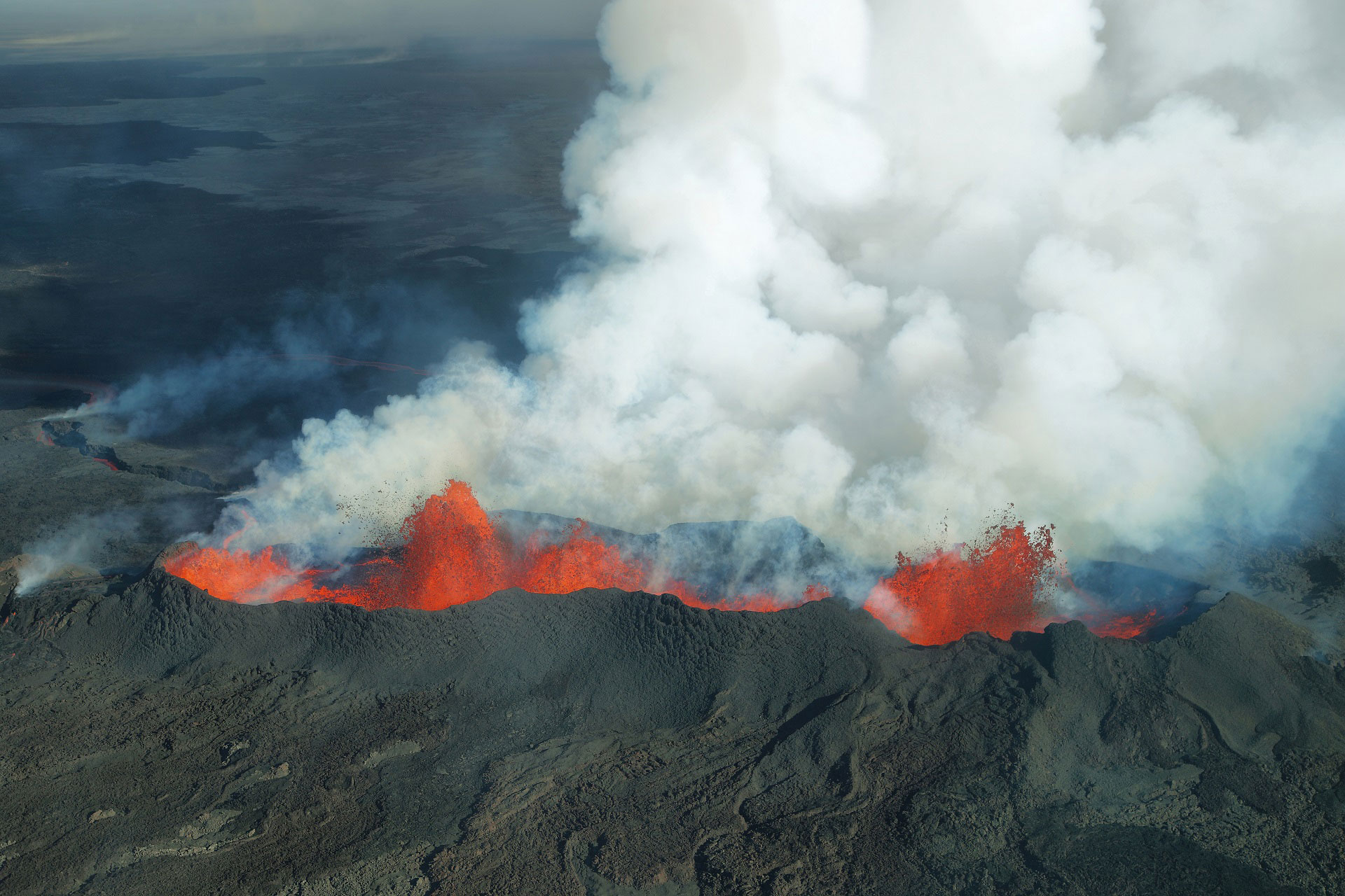
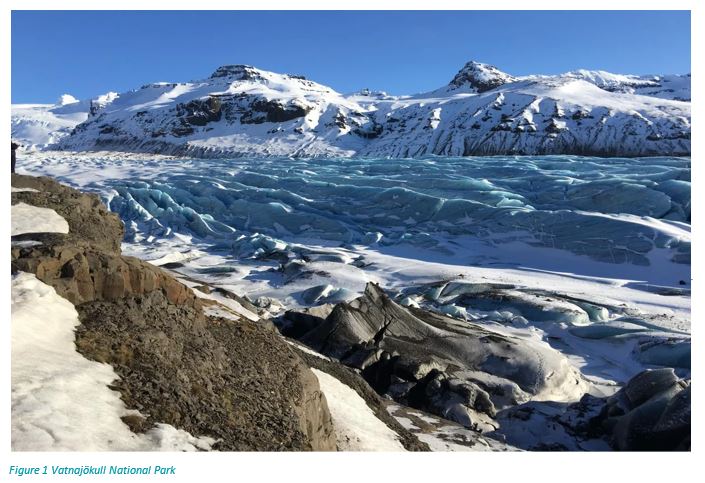
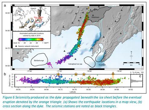
Iceland sometimes experiences lateral migration of magma filled dykes which can propagate for many kilometres underground. Over a 13-day period in 2014, magma propagated laterally from the Bárðarbunga volcano beneath the Vatnajökull ice cap, in the northern rift zone of Iceland, causing more than 30,000 earthquakes. These earthquakes stretched along a 48 km path, at 5-7 km depth, before finally erupting on the 29th August 2014. The University of Cambridge used a selection of Güralp 6TD, 3ESPCD and 3TD seismometers to record and track the dyke propagation beneath the ice cap before it erupted in the largest eruption for 250 years.

Güralp 6TD Solution

The University of Cambridge deployed 45 Güralp 6TDs, 10 Güralp 3ESPCDs and 10 Güralp 3TDs in a dense network across Iceland, focussing especially on the Northern Volcanic Zone (NVZ). 

The 6TD (Figure 2) is an ideal instrument for deployment in difficult terrains: its robust and portable design makes it perfect for quick field installation. The masses do not require locking or unlocking during transportation and as it is a digital seismometer, it reduces the quantity of equipment that must be carried into the field.

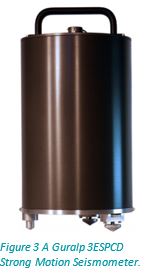
The 3ESPCD (Figure 3) is a small, lightweight, broadband, triaxial digital seismometer, providing weak motion monitoring in a medium-motion sized instrument. 3ESPCDs are used for permanent volcano monitoring networks and long-term microseismic monitoring. They cover the complete seismic spectrum with a single transfer function.

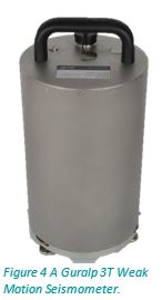
The 3T (Figure 4) is our most sensitive instrument, it covers the entire seismic spectrum under one transfer function and can record frequencies up to 120s. The 3T is traditionally installed in a vault and this weak motion sensor can record clearly earthquakes from across the globe. The 3T is widely used in many National seismic networks, with over 3000 deployed worldwide.

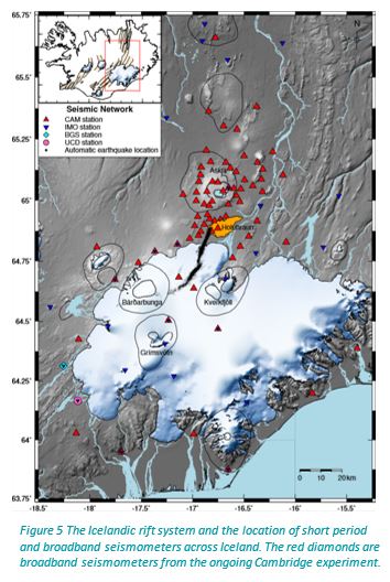
In August 2014 at the time of the eruption, the University of Cambridge had 72 three-component broadband seismometers deployed across Iceland. The layout of the Broadband network can be seen in Figure 5.

Outcomes

Combining Cambridge’s seismic network with 14 stations from the national seismic network of the Icelandic Meteorological Office, 1 station from the British Geological Survey and 1 station from University College Dublin, Cambridge University was able to track a dyke as it propagated in the NVZ.

The 6TDs, 3ESPCDs and 3TDs recorded data continuously at 100 samples per second. More than 30,000 earthquakes were detected during the 2014 Bárðarbunga-Holuhraun dyke intrusion, Figure 6. The seismic network successfully tracked the earthquakes along the dyke as it propagated 48km into the NVZ before its eventual eruption at Holuhraun. Using the seismic data to produce moment tensors, the earthquakes were found to be exclusively strike slip faulting, breaking along the local fabric as the melt forced its way forward. Low frequency tremor and long period events generated as the magma flowed were also mapped successfully using the broadband response of the sensors.


Address:
Güralp Systems Ltd.
3 Midas House, Calleva Park
Aldermaston, Reading
RG7 8EA
United Kingdom

Tel: +44 1189 819056
Email: sales@guralp.com
Copyright © 2024 Güralp Systems Ltd. All Rights Reserved.
This website uses cookies. You may decline the use of cookies for this website but it may impact your user experience. Click on the 'More information' button to find out more about the cookies we use.