Tullow Oil reduces exploration costs with Passive Seismic Surveys using Güralp seismometers
Tullow Oil PLC used Güralp seismometers as a key part of their exploration activities in Uganda. With less than 24 hours of microtremor data from 40 surface seismometers at individual sites, Tullow Oil were able to obtain coarse tomography information about an area and therefore identify likely locations of hydrocarbon reservoirs
A survey was conducted during April and May 2010 in the Albertine Graben region of Uganda as part of hydrocarbon exploration. Recordings were made at locations directly overlying both hydrocarbon and water-bearing strata within the sedimentary basin, as well as at reference sites external to the basin, which were located directly on basement rocks..
A survey was conducted during April and May 2010 in the Albertine Graben region of Uganda as part of hydrocarbon exploration. Recordings were made at locations directly overlying both hydrocarbon and water-bearing strata within the sedimentary basin, as well as at reference sites external to the basin, which were located directly on basement rocks..
Spectograms of the vertical component for the duration of the deployment of the two sensor arrays (Martini et al 2012).
Background
Hydrocarbon exploration in West Africa
Tullow Oil owns a third share in each of four hydrocarbon exploration licences which it operates with its partner companies CNOOC and Total in the Lake Albert Rift Basin.
The Lake Albert Rift is part of the East African Rift system and stretches from the northern part of Lake Albert in the north western part of Uganda to the southern part of Lake Tanganyika in west Tanzania.
Tullow Oil have drilled over 50 wells in Uganda and estimates there is a gross of 1.7bn barrels of recoverable oil resources in the Lake Albert Rift Basin. During the exploration phase, a passive seismic survey was conducted over a three week period in the central part of the graben, close to Lake Albert in the northern part of the Butiaba area.ries.
The location of (a) Uganda and (b) the East African Rift
Güralp solution
The Güralp instruments were deployed at a total of 35 different locations within the sedimentary basin, continuously recording for a minimum of one night at each location (usually several nights). Two reference seismometers remained at the same locations throughout the experiment continually monitoring the reservoir. Two arrays of five sensors as well as several standalone sensors were also deployed at other locations.
The Güralp solution consisted of:
The Güralp solution consisted of:
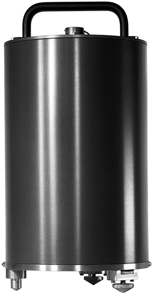
- Twelve Güralp 3ESPCD three-component weak motion broadband seismometers with on-board DM24 digitiser. The sensors have a frequency response from 60 s (0.017 Hz) –50 Hz and a sensitivity of 3000 V/m/s.
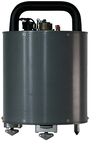
- Five Güralp 6TD three-component broadband seismometers with on-board digitiser and storage. The sensors have a frequency response from 30 s (0.03 Hz) –100 Hz and a sensitivity of 1200 V/m/s.

3ESPCD weak-motion digital seismometer

6TD medium-motion digital seismometer
Outcome
Data were analysed using a combination of power spectrum density analysis, polarization analysis and spatial variation analyses.
P-wave velocities and depth-to-basement were successfully obtained using the data recorded by the Güralp instruments.
Local reservoir microtremor events were recorded each day by the network of Güralp sensors located inside the basin, allowing earthquake phases, converted at the basement interface to be observed at the stations. The time differences between the P and PS, and SP and S earthquake phases were calculated, providing a direct measure of basin structure.
Güralp instruments have allowed Tullow Oil to rapidly deploy a cost effective method for screening large areas of licenced acreage to de-risk investment in active seismic surveys.
P-wave velocity versus frequency plot for one of the arrays. Dispersion curves are shown as black dotted lines and the blue circle indicates the area of low frequency, high frequency arrivals.
References
Martini, F. et al (2013), A passive low-frequency seismic experiment in the Albertine Graben, Uganda. Geophysical Prospecting, 61: 39–61. doi: 10.1111/j.1365-2478.2012.01083.x


