

Instituto Geográfico Nacional, Spain
In 2018, IGN commissioned 17 Güralp stations, ten permanent and seven portable, consisting of a Güralp Radian Posthole and Minimus surface interface unit. The purpose of these stations is to monitor volcanic activity in an area which has
high noise.
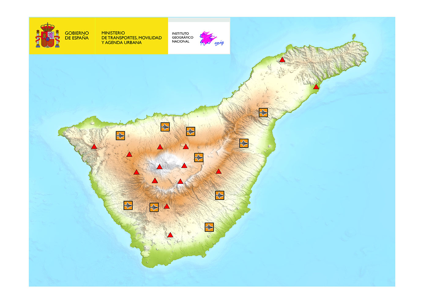
 and location of the new ten permanent posthole stations on Mount Teide")
Current Tenerife IGN Seismic Volcanic Monitoring Network (red triangles) and location of the new ten permanent posthole stations on Mount Teide

Guralp solution
The Radian Seismometer
The Radian is a triaxial, force-feedback, broadband, digital seismometer designed for posthole and borehole deployments.
The Radian was selected for this project because, unlike other seismometers, Radians have a very high inclination range – they can operate at virtually any angle. This capability combined with their slim-line diameter of just 55 mm meant that anchors could be avoided and improved coupling with the surrounding rock achieved by back-filling the installation with sand.
The ultra-wide frequency response between 120 s and 200 Hz makes the Radian ideal for seismic monitoring at all scales, particularly in areas of high cultural noise. For increased flexibility, the high-pass frequency corner can be remotely configured to suit the deployment environment.
Radian Posthole and Borehole
The Minimus
The Minimus is particularly useful for early warning applications as it is Common Alert Protocol (CAP) enabled for automated emergency warning. It also features an ultra-low-latency mode which, when used with our GDI-link protocol, means network transmission can be achieved in 40 milli-seconds (network dependent).
In addition to the Radian, the Minimus can also accommodate an additional analogue sensor such as an accelerometer.

Minimus digitiser
")
Minimus digitiser connected to additional analogue sensor (Fortis accelerometer)
Design and Deployment

Design of permanent station exterior complete with solar panels

Design of permanent station interior

Completed permanent station

Close up showing location of borehole and internal case holding batteries and Minimus fixed to rear wall
Permanent and Portable Seismic Stations
Each permanent installation consists of a PVC borehole of 100 mm diameter narrowing to 80 mm diameter for the last metre of depth. The Radian is installed at the bottom in the narrower section and backfilled with sand to maximise coupling with the surrounding rock. At the surface, each permanent station includes:
- Minimus digitiser
- 3G-4G communication
- Solar panels and battery
- GNSS receiver
- Concrete housing for the station
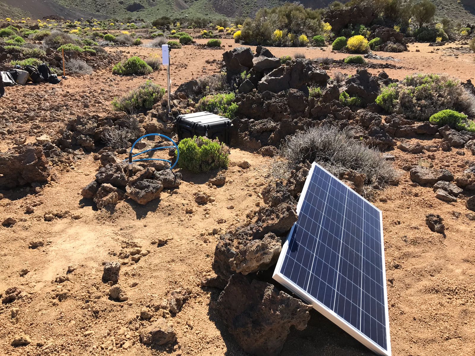
Each portable station design allows flexibility for IGN to install and move the equipment as desired. The Radians are installed using direct burial into a metre of soil with the hole then back-filled.
The portable station equipment consists of:
- Radian Posthole seismometer
- Minimus digitiser, 3G-4G communication and battery housed in rugged casing
- Solar panels
- GNSS receiver

Example of a deployed portable station
Project delivery through our trusted partner
- close collaboration with IGN in developing the design of the permanent and portable stations, including the electronic elements
- construction of the civil works
- assembly of the electronics
- installation of the permanent stations and calibration of the sensors
- and configuration of the data acquisition and transmission settings