
 and location of instrumentation")
WEB NEWS
Seismic monitoring lessons from Magnitude 6.6 Earthquake in Taiwan
The magnitude 6.6 earthquake that struck 20 km off the eastern coast of Taiwan last night, was captured on our newest combination 3T-120/5T borehole instruments 150km away.
The waveform data from the instruments clearly demonstrates the benefit of installing hybrid seismometer/accelerometer instruments in areas that have increased risk of high magnitude events.
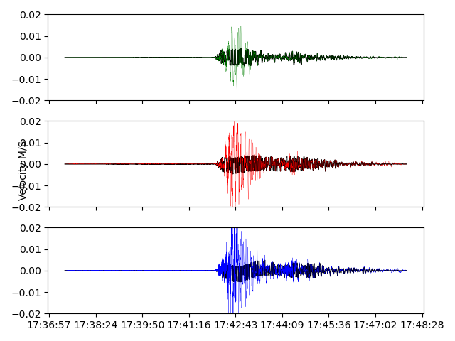
The waveform image (Fig 1) shows the data from five hybrid borehole instruments. You can see that the sensitive 3T-120 seismic sensors (the bottom three sets of waveforms) clipped at the peak of the shaking, whereas the 5T accelerometer sensors (top three sets of waveforms) captured the full event. The full waveform data is required for accurate measurement of the earthquake.
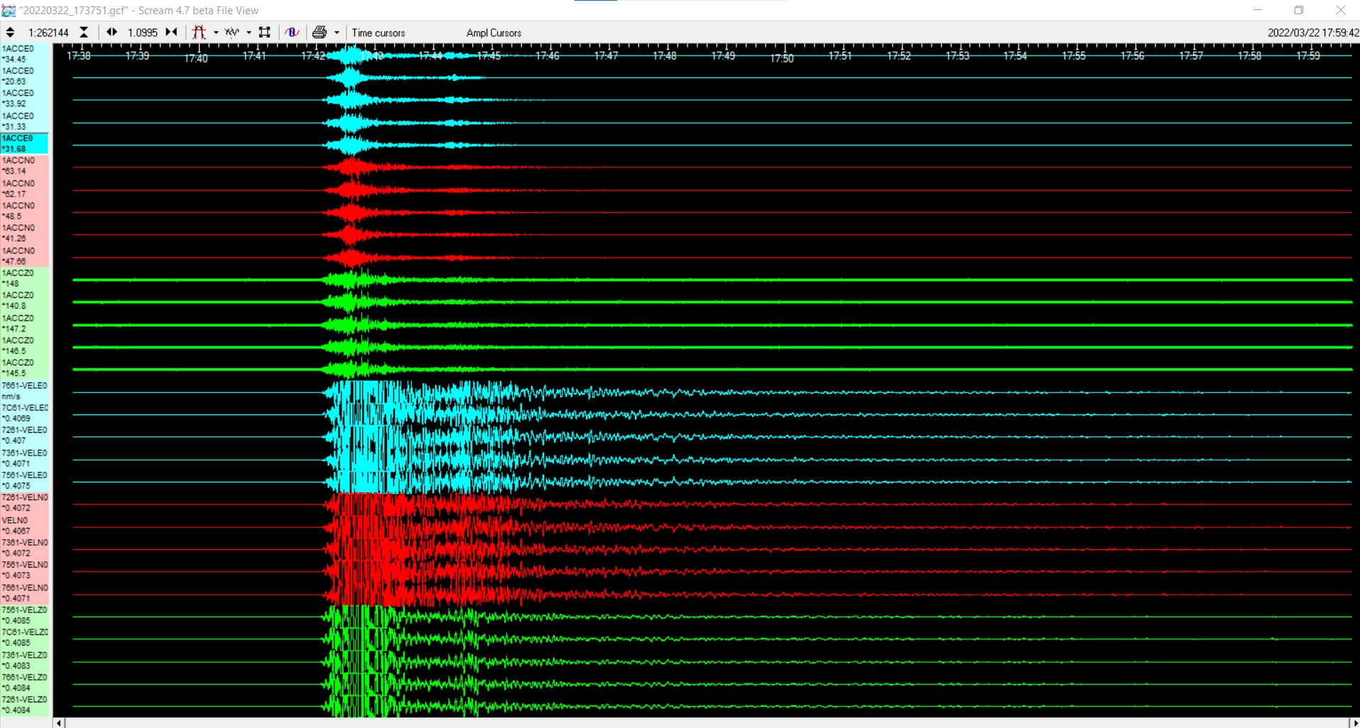
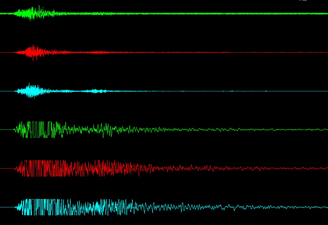
The overlay image below shows just how much data the clipped sensors missed.
The waveform data from the instruments clearly demonstrates the benefit of installing hybrid seismometer/accelerometer instruments in areas that have increased risk of high magnitude events.
The waveform image (Fig 1) shows the data from five hybrid borehole instruments. You can see that the sensitive 3T-120 seismic sensors (the bottom three sets of waveforms) clipped at the peak of the shaking, whereas the 5T accelerometer sensors (top three sets of waveforms) captured the full event. The full waveform data is required for accurate measurement of the earthquake.
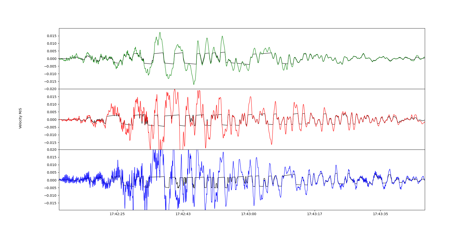
The overlay image below shows just how much data the clipped sensors missed.
Fig 3: Diagram showing clipped seismometer waveforms overlaid against the full waveforms captured by the accelerometers in the hybrid 3T-120 / 5T borehole seismometer

Fig 4: Diagram showing zoomed in waveform overlays captured by the hybrid 3T-120 / 5T borehole seismometer

The zoomed in image above shows how, despite the clipping, the two sets of data, from two different types of sensor, mirror each other impressively well in respect to the overall pattern of the signals.
The Güralp instruments that captured the earthquake were on a 7-day test prior to installation as part of a regional network.
ENDS


NOTE TO EDITORS
MEDIA ENQUIRIES
MEDIA ENQUIRIES TO:
NOTES TO EDITORS:
ABOUT GÜRALP SYSTEMS LTD
Güralp Systems (www.guralp.com) is a leading global provider of sophisticated seismic monitoring solutions used to understand natural seismological events such as earthquakes, aftershocks and volcanos, as well as induced seismic events, or seismic signals, resulting from human activity.Our solutions are used in research, civil and industrial applications to increase understanding, optimise processes and to protect people and the environment. Our equipment is installed in all major ocean basins and across all continents worldwide.
Our instruments range in performance from very low frequency, very low noise for global seismology to high dynamic range instruments for local, strong motion monitoring. Our sensors and can be supplied for deployment at the surface, in boreholes and on the ocean bottom. We also provide data acquisition equipment, power and communication accessories and data interpretation software.
Our services include installation and commissioning; network operation; repair and maintenance services; data processing and interpretation.
Headquartered in Reading, in the UK, we have been operating for more than 30 years and have established a global network of distributors who provide local customer support and sales services.