Summary
World’s first SMART cable
The 21 km SMART (Science Monitoring and Reliable Telecommunications) cable, is an
innovative system developed by Güralp in partnership with INGV for the Italian InSEA SMART Cable Wet Demonstrator project.
Background
A global SMART Cable initiative is exploring a number of ways in which these sensors could be integrated into commercially standard telecommunication cables to create SMART cable systems.
ITU-UNESCO/IOC-WMO Joint Task Force
The JTF collaborates with a number of public and private organisations to assess and develop technologies that have the potential to make SMART cables feasible (Howe et al., 2022).

The InSEA Project
The SMART cable project is funded by the Italian Ministry of Research and aims to investigate the effectiveness of seismometers and environmental monitoring sensors deployed in and around the repeater housings of a traditional telecommunications cable.
(Howe et al., 2022).
In particular, the project is investigating if the system can be deployed in a commercially standard manner without compromising the scientific or operational value of the data being transmitted by the sensors.
The Observation Area
(Tonini et al., 2011).
The in-situ measurements from the deployed seismic and pressure sensors will be crucial for generating reliable tsunami height forecasts for the region and will also aid with improving tsunami warning times.
Figure 1: Map showing the location of the deployed SMART cable
Additional Ocean Bottom Seismometers
The Orcus were deployed in the same area and at the same time as the SMART cable as part of a related scheme within the InSEA project. They provide a high quality reference for evaluating the effectivenesss of the sensors located inside the repeater housings.
Image 2: The observatory grade cabled Orcus OBS is designed to be placed on the seafloor.
SYSTEM DESIGN
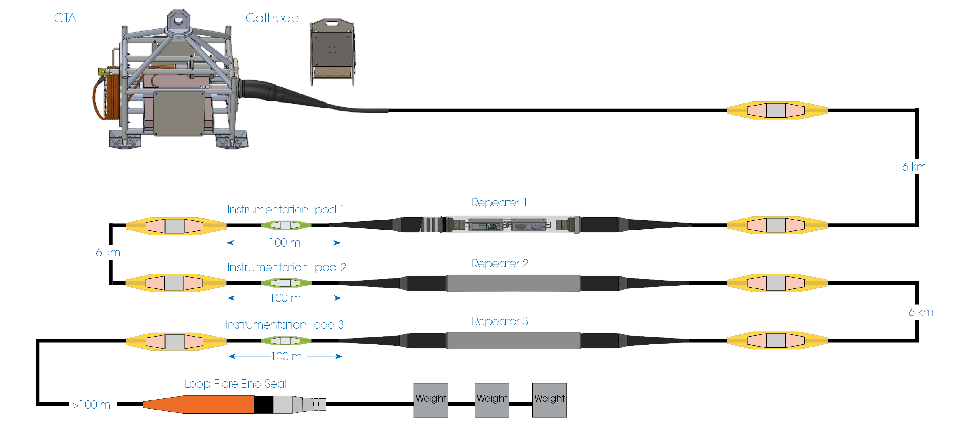
Figure 2. InSEA SMART cable system design
The repeater
The instrumentation
The instrumentation pods house an Absolute Pressure Gauge (“APG”) and a premium temperature sensor favoured by the global ocean science community.
The pod is external from the main repeater and set some distance away to provide the sensors with exposure to the seafloor environment without the risk of heat transfer from the instrumentation in the repeater.
The cable system
The CTA houses the constant current power supply, fibre optic systems and facilitates connection to the sea cathode. The power system uses a single conductor in the telecoms cable and utilises a sea-return via the sea anode.
The repeaters housing the seismic sensors are connected by standard telecoms cable.
The final part of the power system is the sea anode which is housed on the final length of cable in the Loop Fibre End Seal.
INSTRUMENT SELECTION AND PERFORMANCE
INSTRUMENTATION POD:
Seabird SBE 39Plus
The SBE 39Plus temperature sensor has an operating range between -5°C and 45°C with an accuracy of ±0.002°C. The temperature sensor will help to facilitate the monitoring of sea floor oceanographic conditions and will feedback into existing oceanographic models.
Paroscientific 8000 Series
The Paroscientific 8000 Series APG has a depth rating of 3,000m and a precision of <0.01% full scale range. Selected for it’s proven performance and robustness, the Paroscientific 8000 has been successfully used in other Güralp ocean bottom sensing systems. It has also proven crucial for tsunami warning systems globally.
REPEATER HOUSING:
Fortimus
The Fortimus is a modern force balanace accelerometer with integrated digitiser. It has a flat acceleration response between DC-315 Hz. The instruments’ low self-noise, makes the data useful for local and regional seismic monitoring.Certimus
The Certimus is a triaxial broadband seismometer with a flat frequency response between 120 s and 100 Hz. True broadband performance combined with low self-noise makes it well suited for regional seismic monitoring. The Certimus is used globally for applications ranging from volcano monitoring to regional and national networks.SYSTEM INTEGRATION
Design Approach
The repeater
Integrating the sensors
The frames are designed to ensure sufficient protection of the sensor and electronics as well as maximising coupling of the sensor components to the frame to improve performance of the sensors during the deployment.
The instrument pod
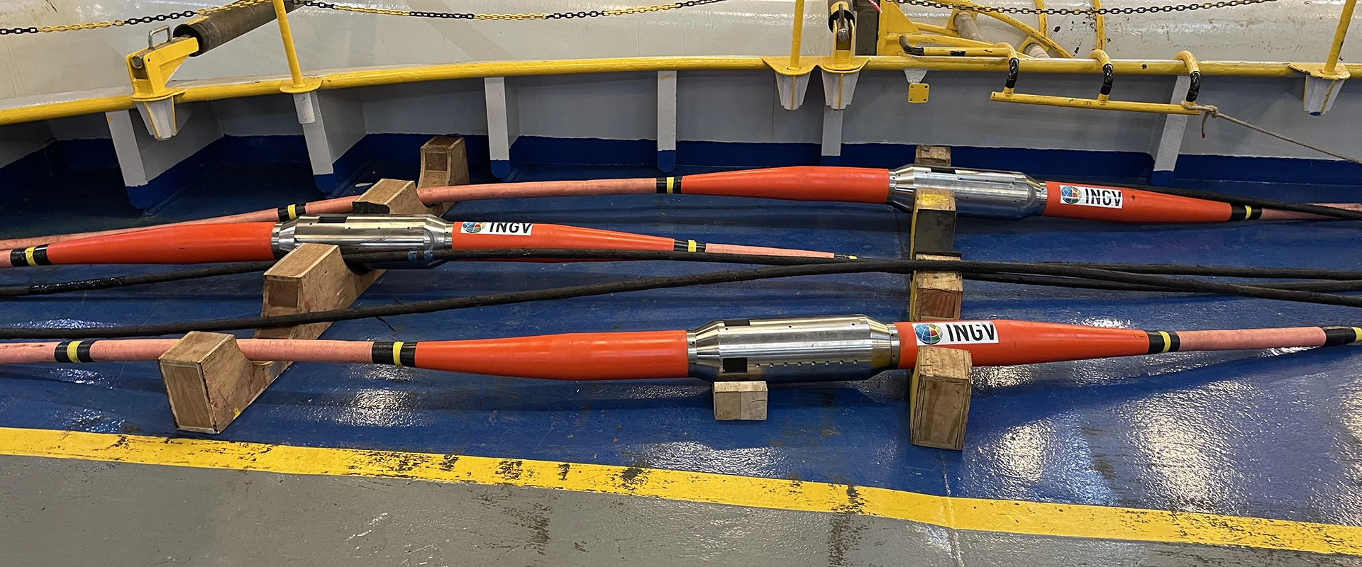
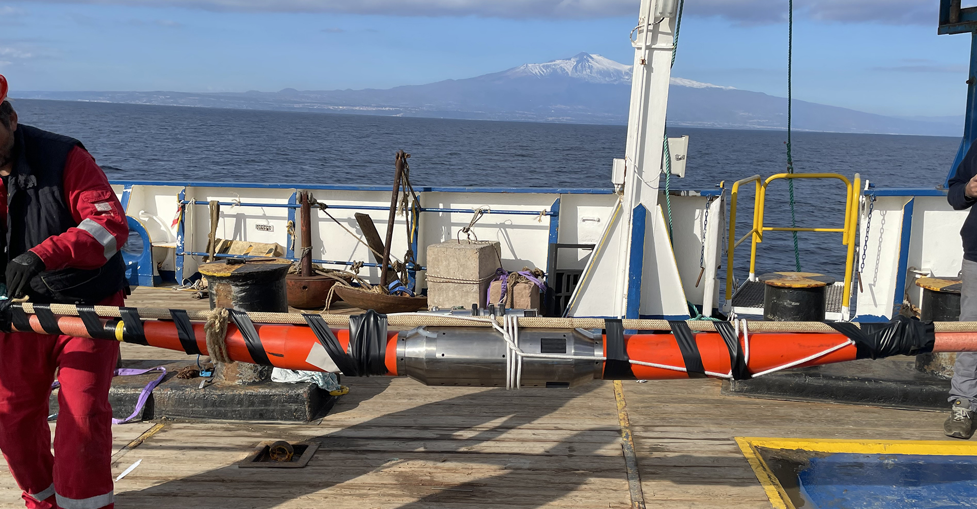
Image 3: The three instrument pods laid out on the cable-laying deck awaiting deployment
DEPLOYMENT

Image 4: Panoramic photo of the ship’s cable-laying deck where the system was laid out and the repeaters were spliced into the cable prior to deployment.
Deployment method
Dockside preparations
the vessel to ensure all instrumentation and hardware was working as expected.
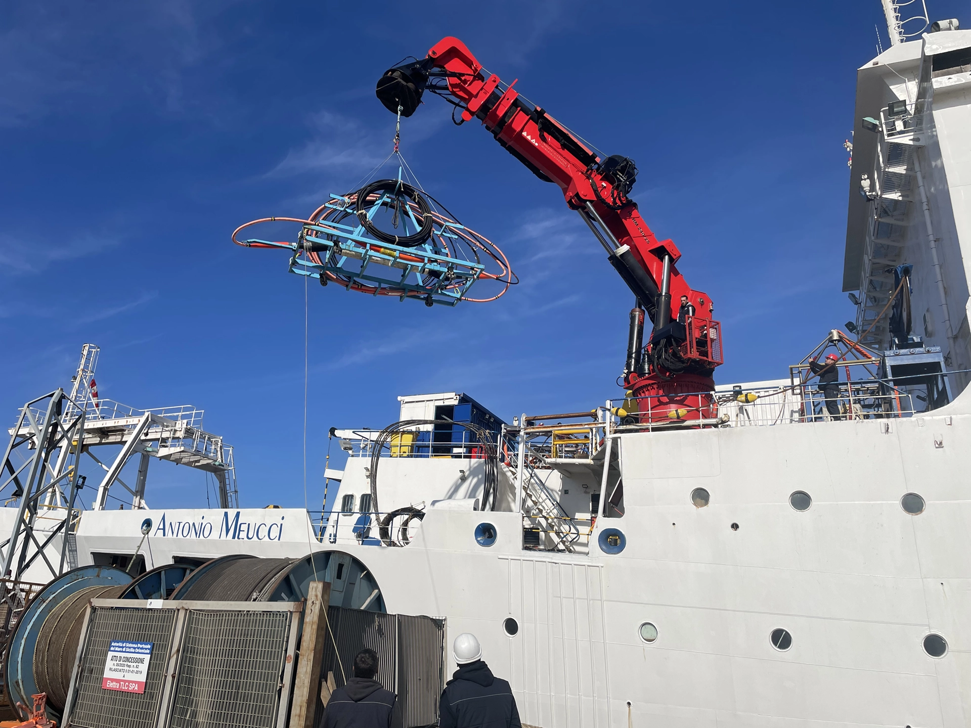
Image 5: Winching equipment from dockside onto the Antonio Meucci
Pre-deployment preparation
Universal joints
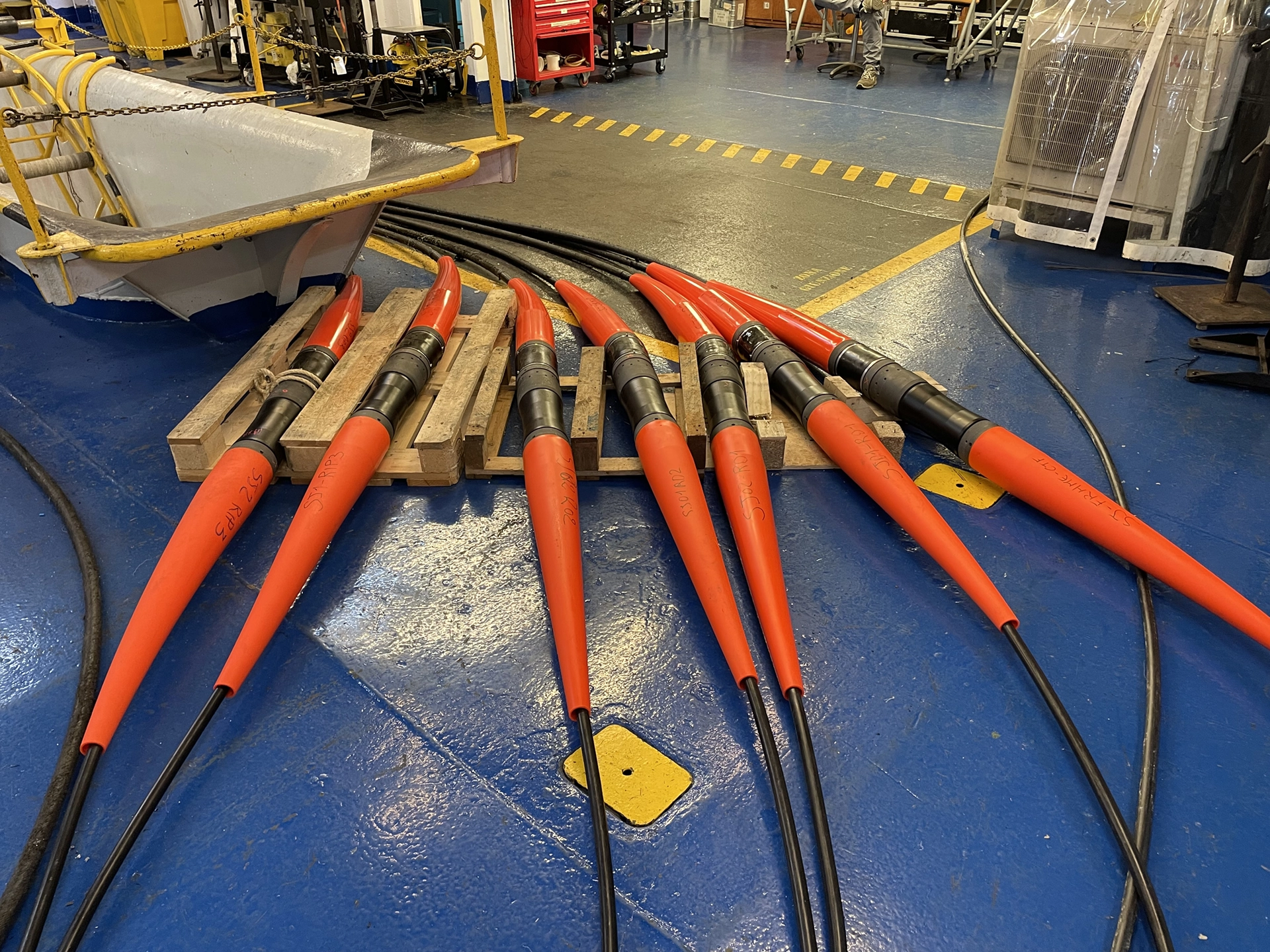
Image 6: The seven universal joints required to splice the repeaters into the cable
Deploying the CTA
the seafloor using a remotely operated vehicle (ROV).
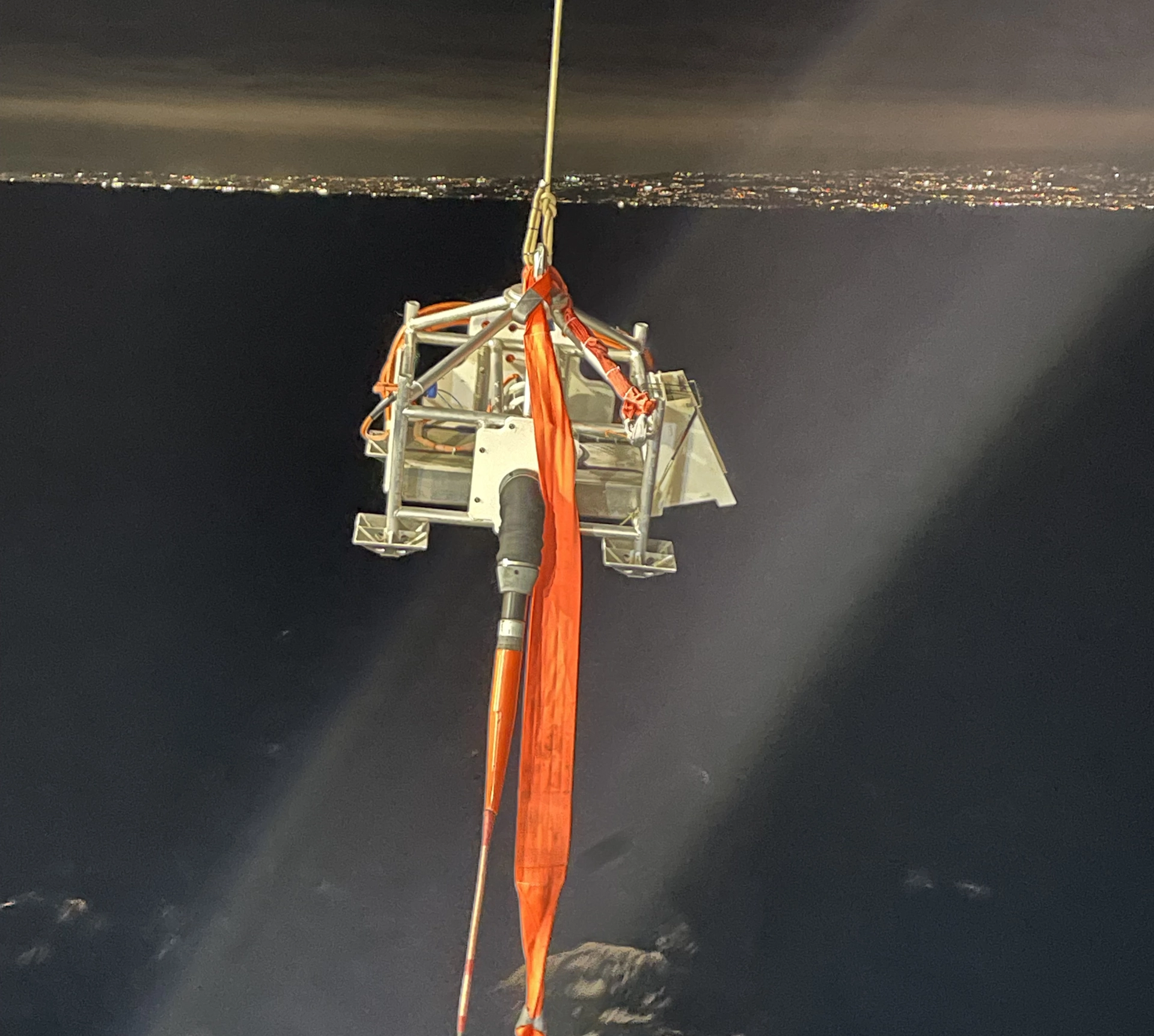
Image 7: CTA being deployed
Deploying the system
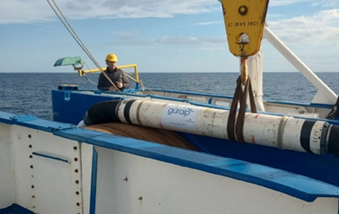
Image 8: Repeater being deployed
The route
A bathymetry map was utilised to ensure the planned cable path achieved an installation depth in the region of 2,000 m and avoided sharp deformation areas or assets already located on the seabed.
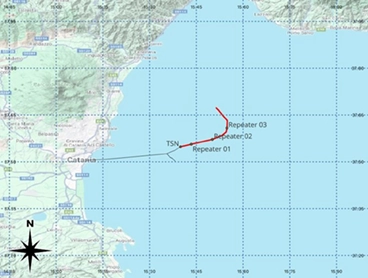
Image 9: Map of cable deployment route
Power and data acquisition
Güralp Discovery software provides an instant view of seismic and temperature data alongside instrument state-of-health data and control over data recording on the instruments.
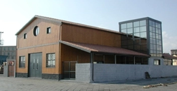
Image 10: INFN Shore station in Catania Harbour
INITIAL MONITORING DATA
CALIPSO reference data
Data from the Orcus OBS (CALIPSO station) is given as reference for each event. It is not a direct comparison as the Orcus is an observatory grade instrument, however it does provide a comparison for the SMART cable data.
The SMART cable waveform data is very closely correlated to CALIPSO waveform data demonstrating successful operation of the instruments housed in the three repeaters.
TELESEISMIC EVENT
01/01/2024 07:10:13 Mwpd 7.4
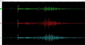
Waveform data: CALIPSO Station
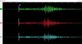
Waveform data: Repeater 1, (Certimus seismometer)
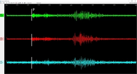
Waveform data: Repeater 1, (Fortimus accelerometer)
REGIONAL EVENT
GREECE
12/01/2024 03:51:07 Mb 4.7
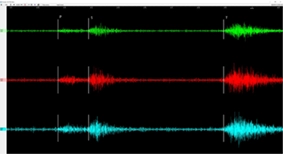
Waveform data: CALIPSO Station
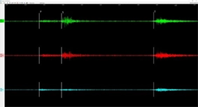
Waveform data: Repeater 2, (Certimus seismometer)
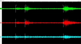
Waveform data: Repeater 2, (Fortimus accelerometer)
LOCAL EVENT
ITALY
14/01/2024 19:53:23 ML 2.0
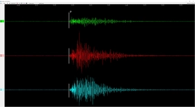
Waveform data: CALIPSO Station
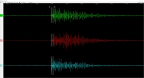
Waveform data: Repeater 3, (Certimus seismometer)
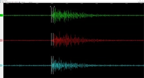
Waveform data: Repeater 3, (Fortimus accelerometer)
Data from the instrument pod
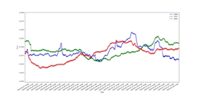
Temperature data from the three SBE 39Plus temperature sensors
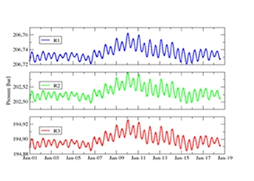
Pressure data from the three Paroscientific 8000 Series Absolute Pressure Gauges
LOOKING TO THE FUTURE
The project has demonstrated that high performance seismic and ocean observing sensors can be deployed using standard commercial telecommunication cable-laying procedures.
The broadband sensor’s ability to work at any angle combined with the engineering effort to ensure that the instruments were coupled effectively with the repeater housing has resulted in good coupling with the seismic sensor.
Initial data would appear to be of a high quality and although not directly comparative to observatory grade OBS data such as provided by the Orcus, we can see with the reference data that it is certainly to be of significant scientific value.
There has already been an increasing level of interest in projects seeking to utilise the SMART cable concept so we are developing our relationships with industry specialists further to ensure that we can respond effectively to any opportunities that arise.
We are committed to further developing this technology and have already identified strategies to explore further improvements to our design.
Vital to our success has been our collaboration with other key parties involved on the project.
INGV has been very satisfied with the level of project management, engineering support and collaboration that Güralp have demonstrated on this project. I wouldn’t hesitate to recommend Guralp as a supplier for future SMART cable projects globally.”
Giuditta Marinaro
Head of Multidisciplinary Research on Geosphere-Ocean-Atmosphere Interactions of the Rome 2 Section of INGV
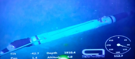
Image 11: Deployed SMART cable repeater on the seabed
References
Observing the Earth and Ocean, Mitigating Environmental Hazards, and Supporting the Blue Economy. Front. Earth Sci. 9:775544. doi: 10.3389/feart.2021.775544
De Santis A, Chiappini M, Marinaro G, Guardato S, Conversano F, D’Anna G, Di Mauro D, Cardin V, Carluccio R, Rende SF, Giordano R, Rossi L, Simeone F, Giacomozzi E, Fertitta G, Costanza A, Donnarumma GP, Riccio R, Siena G and Civitarese G (2022) InSEA Project: Initiatives in Supporting the Consolidation and Enhancement of the EMSO Infrastructure and Related Activities. Front. Mar. Sci. 9:846701. doi: 10.3389/fmars.2022.846701
Tonini, R., Armigliato, A., Pagnoni, G., Zaniboni, F., and Tinti, S. (2011). Tsunami Hazard for the City of Catania, Eastern Sicily, Italy, Assessed by Means of Worst-Case Credible Tsunami Scenario Analysis (WCTSA). Nat. Hazards Earth Syst. Sci. 11 ( ), 1217–1232. doi:10.5194/nhess-11-1217-2011

