Background
The South West Seismic Zone (SWSZ) is an area of Western Australia which experiences small but regular seismic events. While these small earthquakes are more common than the larger ones, higher magnitude events will occasionally occur in the SWSZ as well. In 1968, Meckering experienced an M6.5 seismic event; in 2018, the Lake Muir area was hit with an M5.3 earthquake in September then with an M5.2 event in November; and as recently as 2022, three M>4 events hit the Arthur River community throughout January and February. Now, in 2024, the area of Wyalkatchem has been experiencing an ongoing swarm of seismic activity.
From May 2024, the Wyalkatchem area has recorded 59 earthquakes, most of which recorded a magnitude of 2 to 3, however, this number is not particularly accurate. This is partly because the National Earthquake Alerts Centre (NEAC) in Canberra will only publish seismic events with a magnitude exceeding 2, so it is very likely that there may be many smaller earthquakes that have not been reported at all. Then, in August of 2024, the Wyalkatchem area was hit with two earthquakes of magnitude M>4, large enough to provide important, useful data for engineering and scientific purposes.
From May 2024, the Wyalkatchem area has recorded 59 earthquakes, most of which recorded a magnitude of 2 to 3, however, this number is not particularly accurate. This is partly because the National Earthquake Alerts Centre (NEAC) in Canberra will only publish seismic events with a magnitude exceeding 2, so it is very likely that there may be many smaller earthquakes that have not been reported at all. Then, in August of 2024, the Wyalkatchem area was hit with two earthquakes of magnitude M>4, large enough to provide important, useful data for engineering and scientific purposes.
Güralp Solution
The Department of Energy, Mines, Industry Regulation and Safety procured six kits of monitoring instruments specifically designed to be transportable for rapid field deployments for aftershock monitoring following an earthquake event. These kits comprise of:
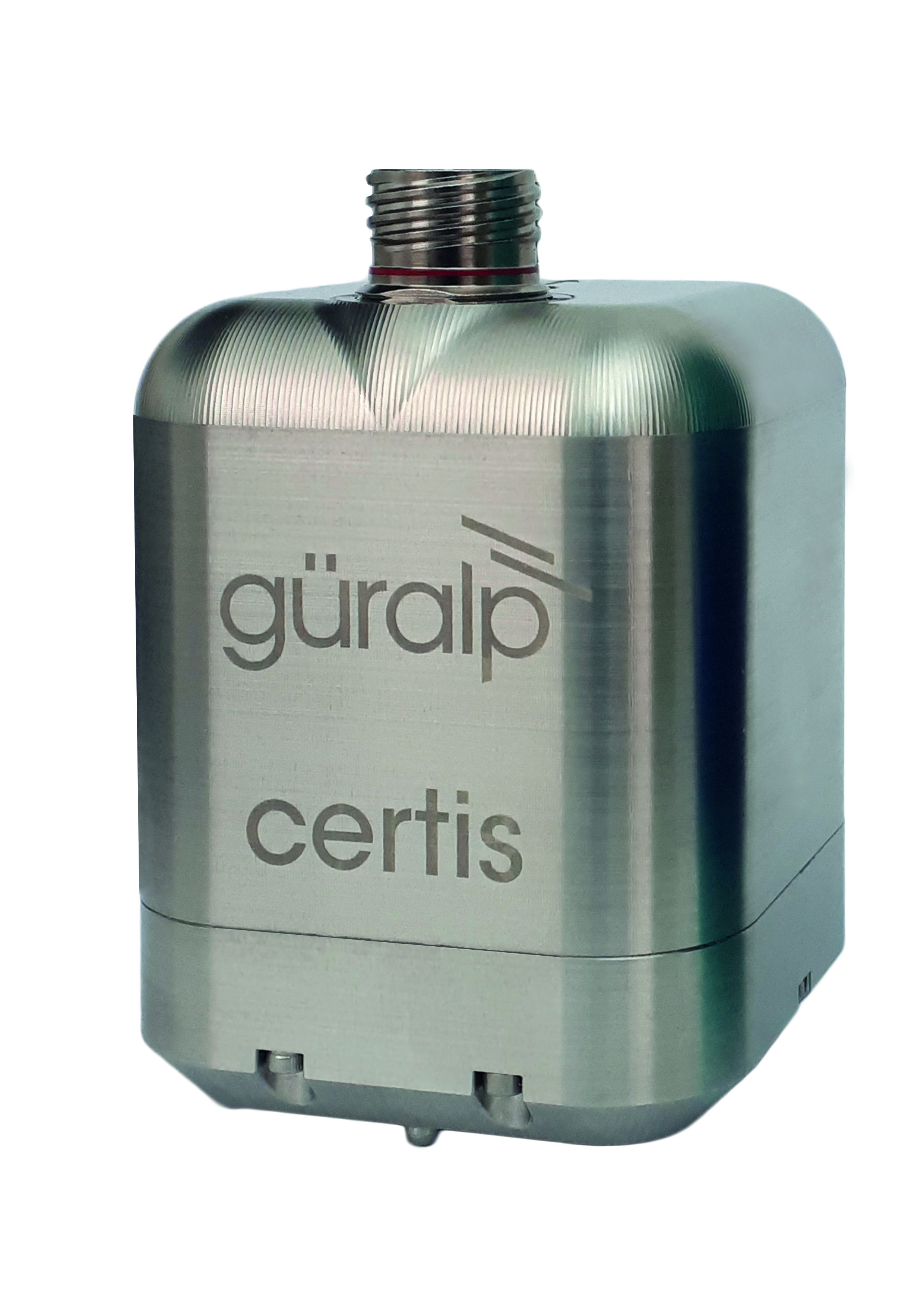
Güralp Certis
The Certis is a compact and portable seismometer with advanced sensor technology allowing for analogue output with state-of-health parameters. It has a wide frequency response of 120 s - 100 Hz and benefits from a remotely adjustable long-period corner between 1 and 120 seconds. Unlike other broadband instruments, the Certis can operate at angles up to 90° from level.
The Certis is a compact and portable seismometer with advanced sensor technology allowing for analogue output with state-of-health parameters. It has a wide frequency response of 120 s - 100 Hz and benefits from a remotely adjustable long-period corner between 1 and 120 seconds. Unlike other broadband instruments, the Certis can operate at angles up to 90° from level.

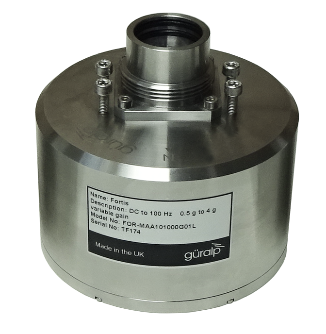
Güralp Fortis
The Fortis is a strong-motion accelerometer, making it ideal for local earthquake early warning and structural health monitoring applications. It features flexible gain options so it can perform optimally in a wide range of earthquake monitoring scenarios.
The Fortis is a strong-motion accelerometer, making it ideal for local earthquake early warning and structural health monitoring applications. It features flexible gain options so it can perform optimally in a wide range of earthquake monitoring scenarios.

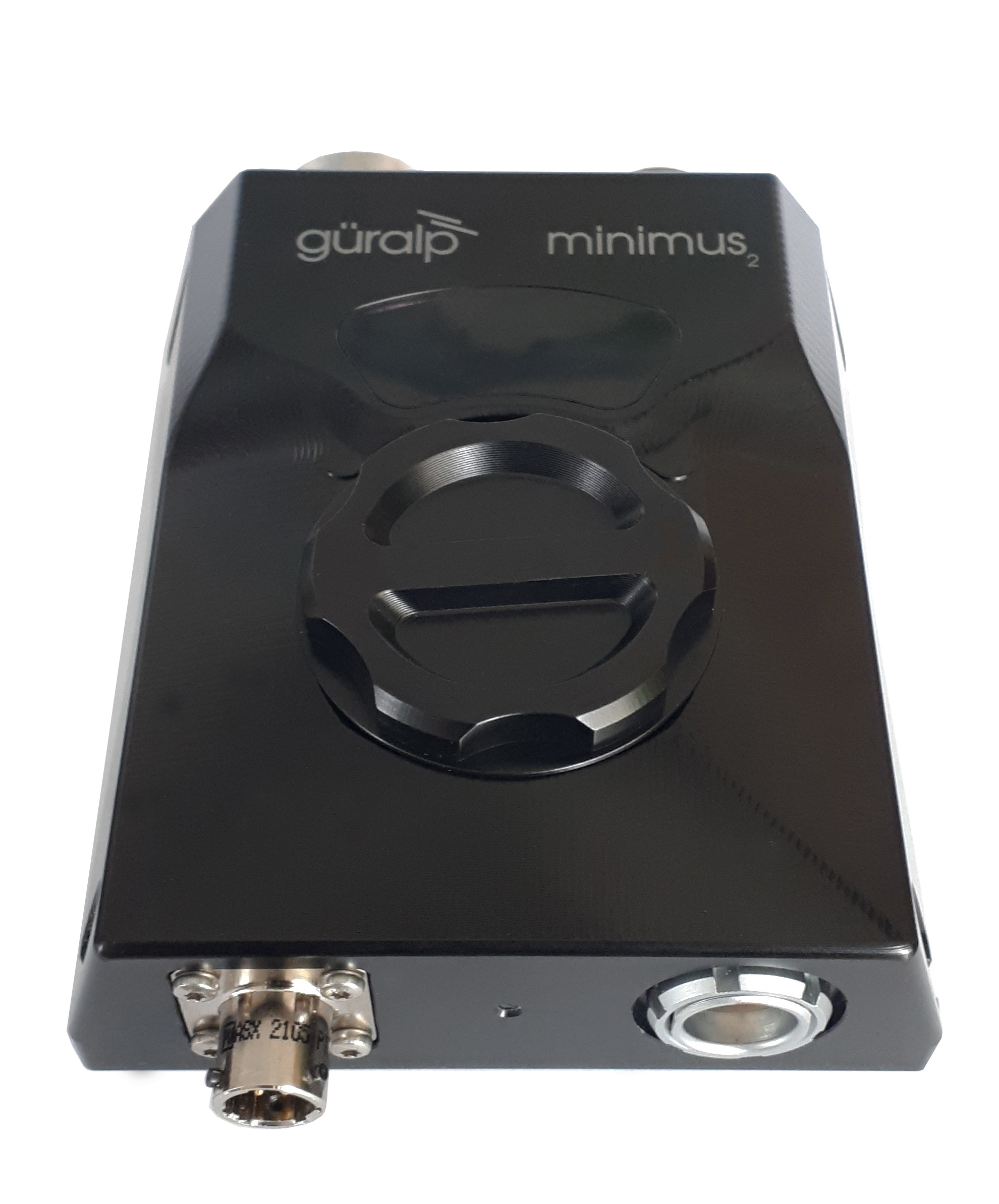
Güralp Minimus₂
Minimus digitisers offer advanced 'smart' 24-bit seismic ADC conversion and are packed with a host of features that make them the ideal 'plug-and-play' solution for rapid deployments and multi-scale networked arrays.
Minimus digitisers offer advanced 'smart' 24-bit seismic ADC conversion and are packed with a host of features that make them the ideal 'plug-and-play' solution for rapid deployments and multi-scale networked arrays.

Figure 1: (From top) Certis, Fortis PostHole and Minimus₂
A power management sytem including solar panels and a battery module
Everything is contained within a purpose-built deployment case, designed by Güralp, for a truly portable seismic station. With no need for levelling, both instruments are designed for posthole deployments which is recommended to achieve the best quality data.
Everything is contained within a purpose-built deployment case, designed by Güralp, for a truly portable seismic station. With no need for levelling, both instruments are designed for posthole deployments which is recommended to achieve the best quality data.
Deployment
Three of the kits were rapidly deployed to the Wyalkatchem area alongside five additional sets of instruments supplied by Geoscience Australia (GA).
The necessity for quick installation meant that the instruments were buried in shallow holes, just a spade depth down. They are placed on a "slab" either a terracotta plant pot base or paving slab which has been firmly pressed into sand. They are then covered with a protective tub and the hole infilled with the original soil. The solar panels are set over the top of the seismometer placement and the deployment case (now functioning as the power and digitizer housing) placed next to it.
Data is being sent via a modem on the Telstra network to the Seismological Research Centre in Melbourne. From there GA, who run the NEAC, can access the data and add it into its alerting system to accurately locate any aftershocks.

Figure 2: Reza Ebrahimi of GSWA installing the Güralp rapid deployment kit in the Perth Hills

Figure 3: The Certis and Fortis-PH being deployed in a pit in the Wyalkatchem region of the Wheatbelt of WA
Outcome
There are a few permanent earthquake monitoring stations in WA, however, the location calculated by this sparse network can be up to 20km in error. With the addition of the new rapid deployment stations, the location of the aftershocks can be realized with far greater accuracy. For aftershocks occurring in populated areas, this will ensure emergency services are directed to where they are needed most and inform residents of the likelihood of continuing damage.
In the unfortunate likelihood that a larger earthquake occurs, these kits will record valuable strong-motion data from rare stable continental region earthquakes, making this globally significant from an earthquake research perspective.
In the unfortunate likelihood that a larger earthquake occurs, these kits will record valuable strong-motion data from rare stable continental region earthquakes, making this globally significant from an earthquake research perspective.


